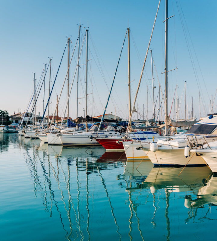
The Porto della Maremma
The Porto della Maremma enjoys a unique position in the heart of the Tuscan Archipelago.
Hospitality, privacy, and comfort can all be found in the port that provides privileged access to help you achieve the dream of the sailing life.
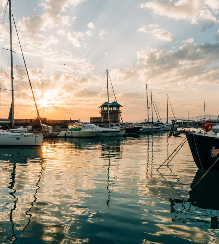
The Porto della Maremma
The Porto della Maremma enjoys a unique position in the heart of the Tuscan Archipelago.
Hospitality, privacy, and comfort can all be found in the port that provides privileged access to help you achieve the dream of the sailing life.
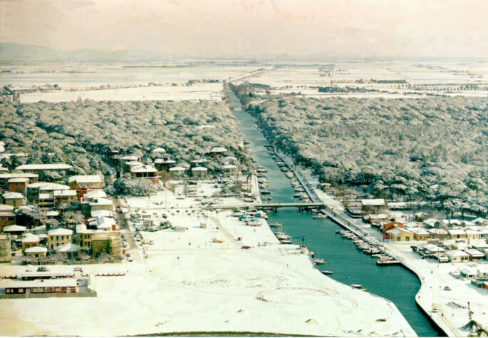
The port's history
It has developed from a fishing port at the mouth of the San Rocco canal, only able to accommodate small boats, to a modern and attractive facility in the heart of the Maremma.
The concept of the Porto della Maremma was first proposed in September 2003 and came to fruition with the official inauguration of the facility in May 2005.
Managed by Marina di San Rocco Spa, the tourist port of Marina di Grosseto has had a Blue Flag since 2006 and is a pioneer of raising awareness and educating the public about eco-sustainability.
Certifications
Marina di San Rocco Spa has chosen to take part in a voluntary certification scheme covering Quality, Environment, and Health & Safety since 2007, based on international standards.
Its corporate culture is oriented towards the progressive improvement of its performance to increase customer confidence, and to selecting partners and suppliers to support competitiveness and contribute to the facility’s continuous development.


![]()
How to get here
By road
From Livorno: go as far as the Casello di Rosignano motorway exit (toll). On leaving the motorway, take the SS 1 Via Aurelia towards Rome and continue to Follonica Nord, exit and follow the signs for Castiglione della Pescaia, then take the SS 322 and follow the signs for Marina di Grosseto.
From Florence: Take the Firenze-Siena motorway and from Siena take the E78 towards Grosseto. Once in Grosseto, follow the signs for Marina (on the SS 322).
From Rome: Take the A12 motorway towards Civitavecchia and continue on the SS 1 Via Aurelia towards Grosseto. Once in Grosseto, take the Grosseto sud exit, following the signs for Marina (on the SS 322).
By boat
Bastia (Corsica) – 68 nautical miles
Macinaggio (Corsica) – 72 nautical miles
Porto Vecchio (Corsica) – 100 nautical miles
Cavallo (Corsica) – 111 nautical miles
Bonifacio (Corsica) – 121 nautical miles
Porto Cervo (Sardinia) – 117 nautical miles
Porto Rotondo (Sardinia) – 121 nautical miles
Porto Santo Stefano (Tuscany) – 18 nautical miles
Porto Azzurro (Tuscany) – 25 nautical miles
Porto Ferraio (Tuscany) – 32 nautical miles
Giglio Island (Tuscany) 21.5 nautical miles
Portofino (Liguria) – 125 nautical miles
Marina Riva di Traiano (Lazio) – 60 nautical miles
By plane
Pisa International Airport
“Galileo Galilei” – 146 Km
Florence-Peretola Airport
“Amerigo Vespucci” – 169 Km
Rome Airport-Fiumicino
“Leonardo da Vinci” – 182 Km
Bologna-Borgo Panigale Airport
“Guglielmo Marconi” – 260 Km
Rome-Ciampino International Airport
“G.B.Pastine” – 200 Km

By plane
Pisa International Airport
“Galileo Galilei” – 146 Km
Florence-Peretola Airport
“Amerigo Vespucci” – 169 Km
Rome Airport-Fiumicino
“Leonardo da Vinci” – 182 Km
Bologna-Borgo Panigale Airport
“Guglielmo Marconi” – 260 Km
Rome-Ciampino International Airport
“G.B.Pastine” – 200 Km
Data sheet
COORDINATES: latitude 42° 42′, 7 north ; longitude 10° 58′, 8 east
N° OF MOORINGS: 557
ACCESS HOURS: 24 hrs
TRANSIT BERTHS: 54
MAX LENGTH: 24 m
DEPTH AT THE DOCK: 2,50 m
SEABED TYPE: sandy
SEABED DEPTH AT THE HARBOUR ENTRANCE: 2.5 meters in favourable weather and 2.10 in unfavourable weather
ON ENTERING THE PORT: during manoeuvres to enter or leave the port it is advisable to follow the centre line of the access channel and keep your line in the event of other boats crossing your path.
MOORING: with deadweight anchors and bollards on the quayside
SIDE WINDS: quadrants III – IV Ponente and Maestro
SHELTERED ANCHORAGE: quadrant I
BEACONS AND LIGHTHOUSES: 2134 (and 1472) – steady green light, 2 vertical, range 3 metres, at the head of the pier.
2136 (and 1474) – lighthouse with white flashing light, period 6 secs., range 11 metres, on the island of Formica maggiore (Formiche di Grosseto)
VHF: channel 9 control tower
NEAREST SAFE HARBOUR: Gulf of Talamone and Cala di Forno south of the port; Le Rocchette to the north
Port regulations
Safety procedures